
Tuchan
Romans, Cathars and Wine-Makers
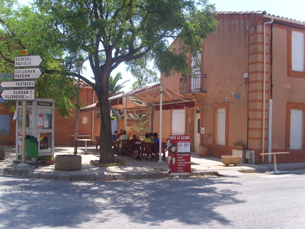
You can find Tuchan on the D611 some 30 km south of Durban-Corbières, itself to the south of Lézignan-Corbières. It is on the west-to-east mining route, now the D39, of the Celts and then the Romans.
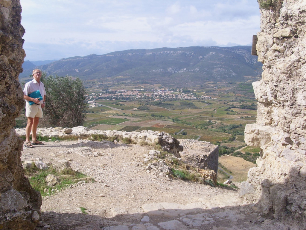
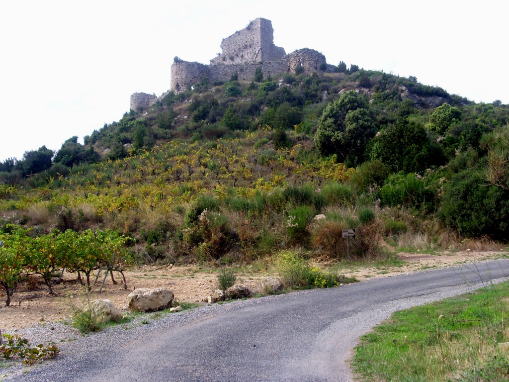
The village and the mountain of Tauch as seen from the castle of Aquilar
Tuchan was founded by the Roman coloniser, Tuscius, around 50 BC. The Romans were then searching for mineral sources and had made many mines in the Corbieres by 30AD of lead, tin, iron and copper, galeries still exist on the mountain of Tauch. Both the town and the mountain are named after Tuscius, who planted vines on the south-facing slope of the mountain. All around the plain of Tuchan Roman remains have been found. It was an important metropolis in Roman times, with farms, industries and villas, with a Roman watchtower or custodia where is now the Chateau of Aguilar, overlooking the road that came from the sea.
Today’s village is situated in the centre of a fertile plain to the south of the Montagne de Tauch, one of the highest in the Corbières at 917m, and famous for its wines. There is an orientation point and a radio tower on the mountain; at one time a meridian ran through that spot, connecting Dunkirk with Barcelona. Ancient peoples lived on the mountain; archeologists found a small cave with a stalagmite in the centre of it. Bronze remnants dated it Neolithic.
Tuchan is large for a Corbières village with a population of 1,500 people. The little river, le Petit Verdouble, crosses the area from north to south, sometimes bringing floods from the Serre de Quintillan mountain to the north, before it joins the Verdouble, 2 kms to the east of Paziols. In the middle of this flood plain you can see, at Les Faychettes, work done in Roman times to drain the area.
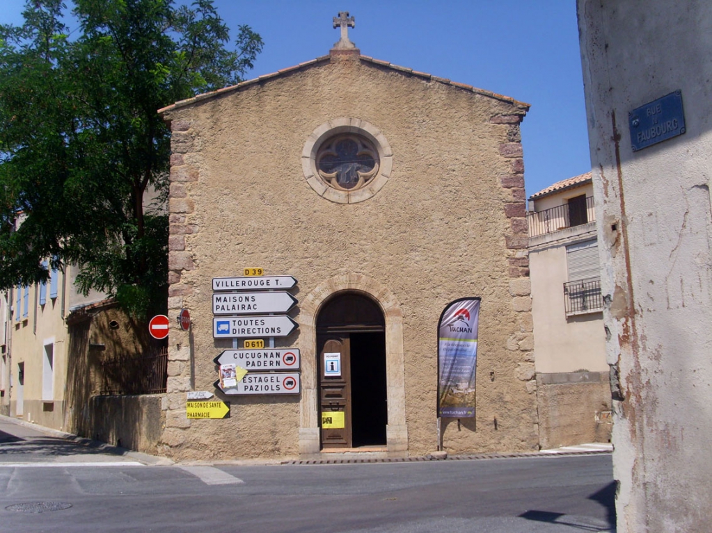
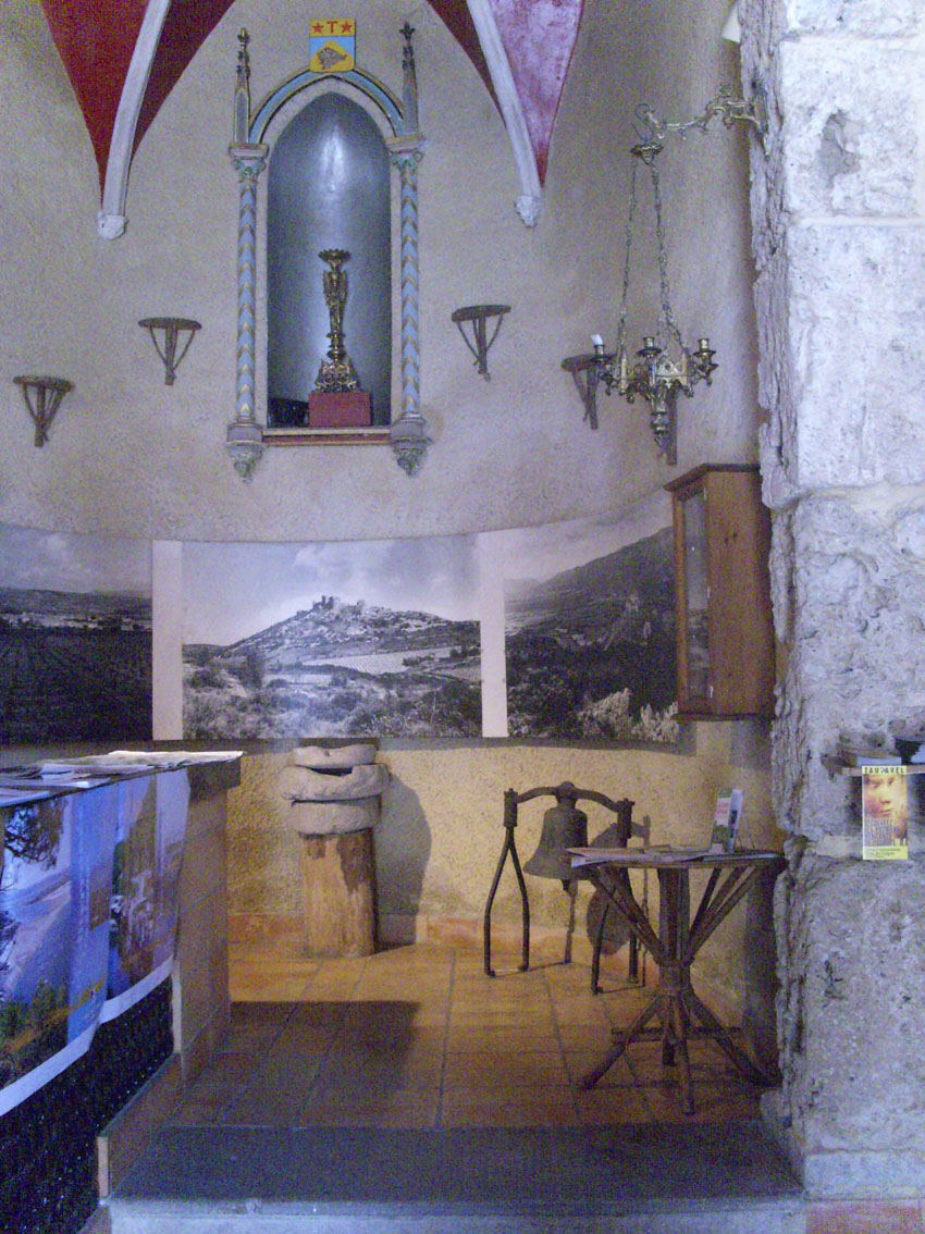
As one approaches Tuchan one see a chapel straight ahead; but this is now the Tourist Information Office! It is worth seeing, however. It is neo-Gothic, being constructed in 1840 to give thanks for a child that was cured. Before that was an oratoire on the spot, so people could pray before they entered the medieval town walls. Wayside crosses outside a town like this were everywhere in medieval times. The chapel is called Notre Dame des Anges. Inside are three Roman millstones and a vase from a fourth century tomb - it’s the nearest thing to a museum that the town has, which is amazing considering the vast Roman history there.
By the 10th century, the village of Tuchan was known as Castrum de Tuchana; it would have already had ramparts by then. It belonged to Bernard d’Aton in 1084. The Aton family from Ariège were Cathars.
The village was walled and very tiny, just the fort and 8 houses. Many villagers made their homes outside the walls, to be closer to their sheep and olives and vines. Until the Treaty of 1657 with Spain, they were constantly harassed by the Spanish; in 1525, every single villager was put in the Castillet prison in Perpignan. They were released once a ransom was agreed, except for those poor souls who had to remain as hostages until the ransom was paid.
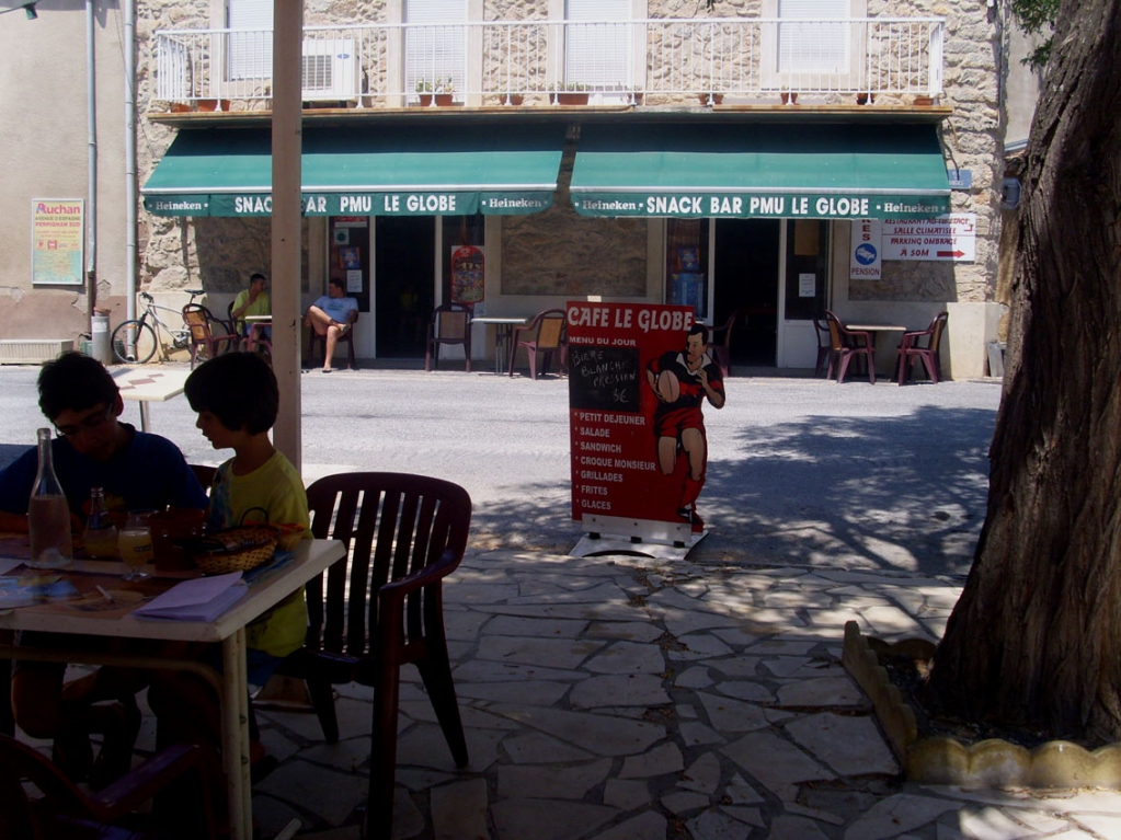
Today the village is pleasant with tiny medieval streets one minute and broad promenades with fin-de-siècle houses the next. There are two restaurants at Tuchan, with quality set menus between 12noon and 2pm, but what it you just want a snack, at a café-bar? There is one opposite Notre Dame des Anges; tables are set out under the trees of a small shaded square.
But where is the site of Tuscius’s original villa or farm?
My first hunch told me it would have been under where is today’s St. John the Evangelist church in today’s town centre. The Romans liked to build their villas about 700 metres away from a main road, and the Roman road passed to the south of where is today’s village. My archeology book tells me that “at the place called Les Courtels, several hundreds of metres to the north of the Fort of Tuchan, were found traces of ancient cadastres (land registry plots) plus shards of Roman pottery from lamps and amphores etc, and the grave of a child, which indicated a modest Roman dwelling.”
Les Courtels is marked on the map, on the other side of the rue de la Promenade, behind the municipal workshops and the Spar supermarket, some 200 metres to the north of the St. John the Evangelist’s church. So it seemed to me that Tuscius’s original villa would have been where is now today’s church, and his farmworkers lived at Les Courtels.
Then, I saw in the offical tourist guide for Tuchan that “La Gleisa Vielha” or old church, near to the cemetary to the south-west of the village was the site of the original Roman habitation - that is, where Tuscius and his family lived. It doesn’t say how they work it out. There wouldn’t have been a Christian church there in the time of Tuscius so what or where was the “old church” by the cemetary? There is no trace of one now but one existed there, the official quide book says, from the time of Charlemagne.
Meanwhile, the oldest part of Tuchan is around “The Fort.” In 1679 the fort sheltered some 20 houses, some of whom still exist. Inside it was a chapel, where the church-goers who had abandoned “La Gléisa Viélha” in the 14th century worshipped. They felt safer there, presumably. Then the fort, no longer needed so much because the border with Spain had been fixed, became the church of St Jean, and it and the houses were walled in, behind ramparts.
The church was a fort? We found the side-door, which had a design of hearts on it, and a pentacle of stones in front of it. and went in.


I found the church sinister. As it was converted from a fortress, it is vast. And dark - there are no windows. Forts had small doors and no windows, I can imagine nothing worse than being trapped in one with the enemy battering down the door. There is a water-source or well there, essential for any self-respecting fortress, people cannot withstand a siege without water. Today it is a hole in the wall, with a deer painted on the wall beside it.
The notice outside says; The Fort - Church of St. John. Established inside the Fort in the 14th century, but was destroyed by the Spaniards during the rampage of Tuchan in 1545, it was rebuilt in the seventeenth century. In 1856, the Catalan style metalwork replaced the tiled roof of the belltower, which used to be the prison tower.
Oh shivers! A prison, no doubt with dungeons, and where people were tortured. I wasn’t sure this was a suitable site for a church. Maybe there was a fort with a small chapel inside it - to say prayers for dead soldiers perhaps - but no way could it have always been a church as the notice implied. The fortress served during the War between France and Spain over the border, which was finally resolved in 1657. People fought there, and died there, and suffered there, and prisoners were tortured in the tower.
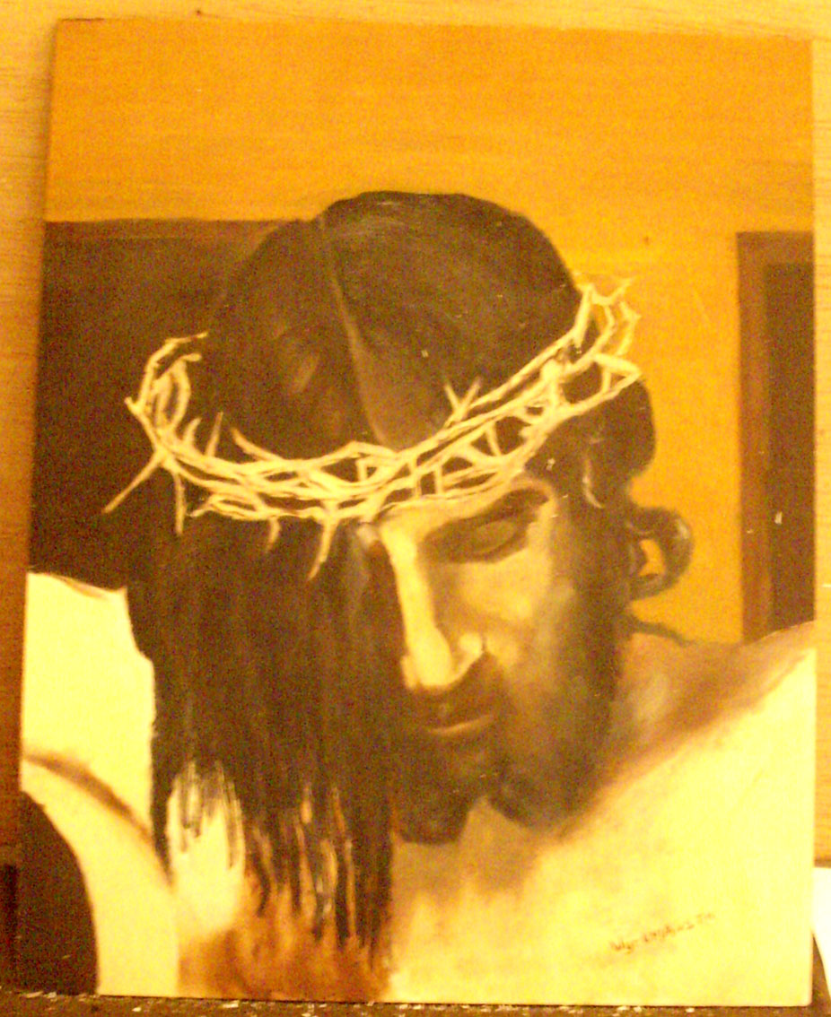
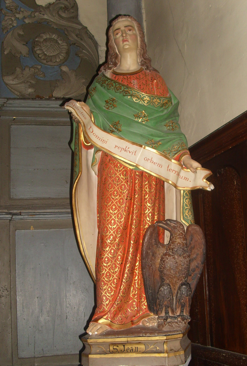
It is very Jesus-orientated, with many statues and also contemporary images of him everywhere you look. Even the painting of the crucifixion above the altar shows St. John (as Lazarus is always called and he always looks like a girl) and the Virgin, but no Mary Magdalene. There are also many images of “St. Jean the Beloved Disciple” which is understandable, after all, the church is dedicated to him. One statue showed him holding a banner in Latin, saying “The spirit of the Savour fills the universe.”
However, there were many other interesting statues, including Notre Dame de Salette, who began life as a "white lady."
I felt strongly that the church at Tuchan may well be a place where conventional Catholics worship, but it was definitely never “a sacred place.” There are other places in the Tuchan commune that were sacred places long before the fifteenth century arrived. As far as I am concerned, priests can consecrate and re-consecrate as much as they want, but saying a few ritual words will not make a place holy. So what will?
I love the old churches and chapels of the Corbières and have been in many of them. It seems to me the older they are, and the longer they have been thought of as special gathering places for religious purposes (whatever that religion was) the more sacred or holy they become.
In our region we can go back to the Celts who made their sacred places here. The plateau of Salveterre near Opoul-Perillos was a Celtic meeting place or nemeton, so was the graveyard at Rennes-les-Bains. These nemetons were “clearings in a sacred wood” and beside a natural source of sweet water. The Druids came to perform their four annual festivals, and then the people rejoiced for the next two or three days.
A place becomes sacred through the use of it as a sacred place, where there is a special energy. Even I, the biggest Philistine in the world, can sometimes feel it. We hear so many times, throughout the south of France, of churches built on the site of a Roman Temple, such as Rennes-le-Château, a Mary Magdalene church built over a temple to Isis, and Notre Dame de Garde at Marseille on the site of a temple to Artemis.
Then we went to have a look at the cemetery; to the direct south of the Fort. On my map was a small cemetery with a chapel marked nearby; but the cemetery has been recently enlarged and the chapel engulfed. This is where the original church would have been, possibly in the ground of Tuscius's villa.
From the front of the cemetary is marked a “Sentier Cathare” or Cathar’s footpath. This takes a cross-country route before meeting up with the main road to Padern further south. The path is marked by brightly painted logos on nearby rocks. If this track was used by the Cathars, it was already 800 or more years old then; it seemed to me it was an ancient Roman road.
We found a modern well, probably a water-source in Celtic and Roman times. Why would a modern farmer sink a well in the middle of a track? And then we found a place where chariot wheels had cut ridges into the bedrock - immediately I had visions of all the carts from the iron mines coming to and fro here. I found some fragments that the President of my historical society later identified as Roman.
Notre Dame de Faste
Those interested in old churches and chapels might be interested in taking the 5 kilometre long “route equestrien” up to Notre Dame de Faste. Find the road near today’s cave co-operative. To the right of the Rider’s road, is the Puy de Lagardie, and this part of the road was enlarged in 1936. Two tombs were found with bones, and some sigillee pottery and a lamp.
You can turn left for a picnic spot with a spring, the Fontaine des Artigas, or you can go straight on to the Chapelle de St. Roch, a favourite saint in Languedoc. Near there, in 1897, was found a Roman coin, a sesterce of Gordien III.

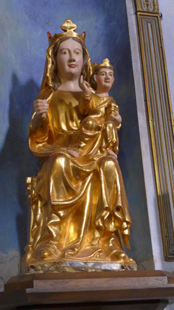
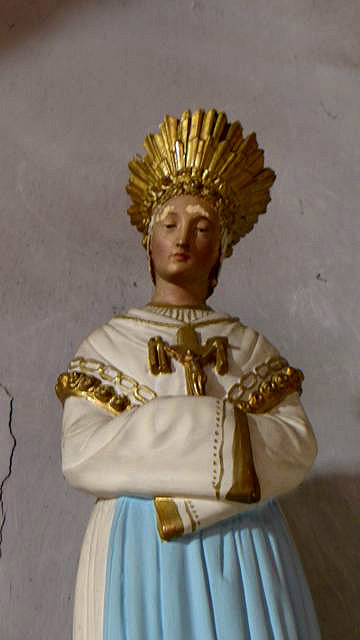
ND de Faste, and its Virgin, now in the main church in the town
Legend says the chapel of Notre Dame de Faste was built by sailors who, fearing for their lives during a stormy night at sea, sailed towards a distant light that they later identified as on the Montagne de Tauch, so built the chapel on that very spot. For the Roman mining route across the Corbières became the route the sailors from Ariège took home from the coast after maybe years at sea.
Faste was a village in its own right until 1790. The chapel was a large church dedicated to Ste Marie - the Virgin. It was probably much older than the first date it was documented, 1119. Before being re-built in the 15th century, it was a curious church with two naves, implying it was built on top of a building that was not a church; the one from which the light shone in the storm perhaps?
Pilgrimages began in the 15th century to venerate a Virgin in wood, already 100 years old. Today they come from nearby villages at Pentecost (Whit Monday) and on the 8th September, a Virgin Mary fête day; it was her birthday. Concerts are held in the summer by the Friends of the chapel. There's also a mass said on the last Sunday of August every year.
Now the statue of the Virgin has been “taken away to a safe place.” It is, in fact, in the church of St. John the Evangelist.
The Cathar castle of Aguilar near Tuchan
The “Cathar castles” were those that played a great role in protecting, or trying to protect, the local people and the territories of the great lords that ruled them. The prevalent religion of the region for hundreds of years was Catharism until the 13th century. Aquilar, Queribus and Peyrepertuse are called by the French, the forgotten Cathar castles of the Corbières. This is because their role is often minimised in conventional histories about Catharism. However, they are part of the five daughters of Carcassonne, Aquilar, Queribus, Puilarens, Termes and Peyrepertuse.
Aquilar near Tuchan is open most days, but for shorter times in the colder months. You can walk to the chateau from the town, following part of one of the great Sentiers Cathare, from Foix in the Ariège to Port La Nouvelle on the coast.
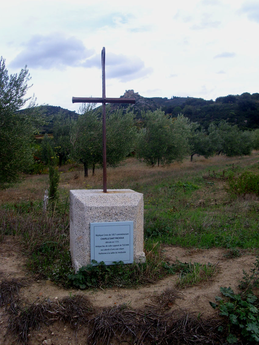
On the way you pass a site marked by an iron cross beside which is a notice telling us it commemorated the Chapel of St. Fructeux, destroyed in 1725. Nothing is visible now, but there was a farm here, built by a family coming from the Spanish coast in Roman days. It was abandoned in the 3rd century when a new house was built several hundred metres to the south, alongside a ford - maybe a watercourse had changed direction. Ruins were still in existence in the 6th century, when the Visigoths came. Then a chapel was built to the Spanish saint Fructeux, but no exact date has been found. For some reason (shades of heresy?) the building was destroyed in the 18th century.
Fructeux was the bishop of Tarragona martyred in 259AD, after which the devotion to him expanded in Catalonia and reached Narbonne. Local historians think this Chapel of Fructeux therefore, was one of the earliest places Christian worship in the region, at Tuchan.
The walk up to Aquilar is quite strenuous, especially as you near the top! It’s 296 metres high, nearly 1,000feet. You can also drive, but must park on the left before going to pay at the entrance. Then the path is even steeper, so wear proper shoes, and take a sunhat and a bottle of water. Be prepared to spend a couple of hours investigating.
The site of the castle has played a protective role for more than 2,000 years, it is very old. “Several centuries before our era, this land was fought over by the Sordes and the Elysiques” says a guide book; these were two Celtic tribes who lived in the area. Settlements have been found at the foot of Aguilar. (The Elysiques are particularly well-known for their oppidums of Pech Maho near Sigean and Montlaurès near Narbonne.)
On the hill of Aguilar modern excavations revealed fragments of sigillee, amphores, roof tiles (tegulae) and a millstone in basalt. All this indicated a Roman watchtower on the site. On top of this hill, visible from miles around, was a small Roman garrison, but their function would have been to protect the trading routes and the mining products goods carried along them and to see that taxes were paid. The Romans were mining iron, silver and lead, copper and tin. This traffic passed along today’s D39.
Roman remains found near the castle included amphores from Italy and Taragona, in Spain, and various ceramics, millstones in basalt, roof-tiles, dolia (huge storage jars), a ring and a belt buckle in bronze. Two farms of Roman origin are still marked on the map, Borde de Marsal and Bordeneuve. These are Occitan names.
Aquilar and the Cathars
After Roman times there is a gap in the history of the castle, until it was mentioned in a document of 1004, listed in the possessions of Bishop Pierre from Aragon, who wanted it to defend the border between France and Spain It was probably he who renovated or re-built the inner keep. A few years later the castle, known as the “rock of Eagles” belonged to the Count of Besalu.
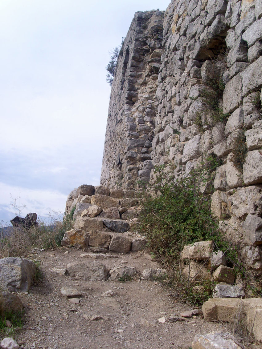
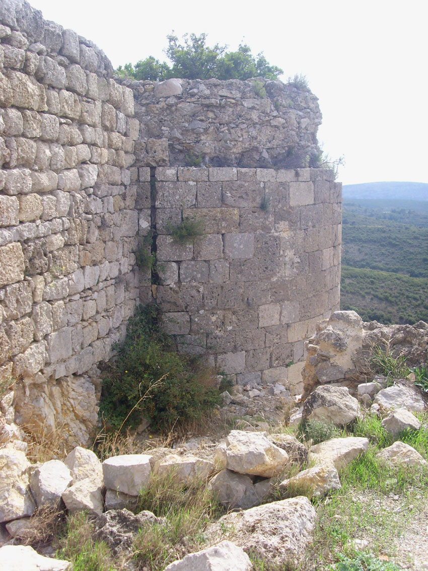
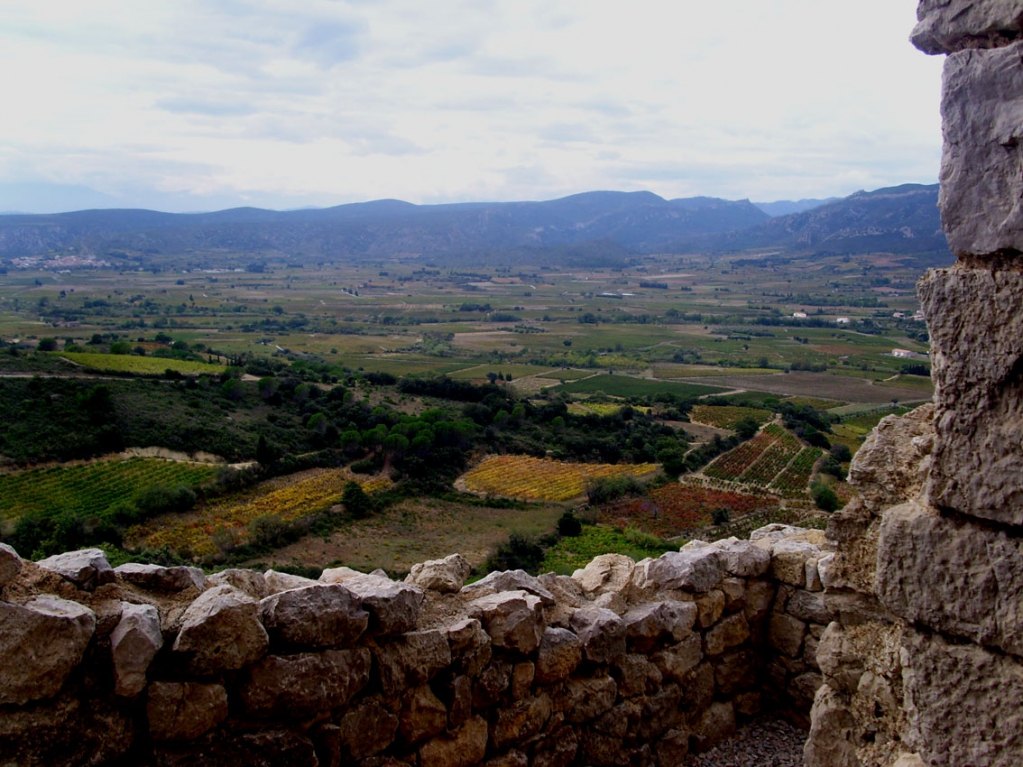
The castle dominates the verdant and fertile plan of Tuchan and would have been built to control trading but now the threat was from Spain. It mght have been then that the outer ring of walls, with 6 barbicans, was built. The barbicans were circular defence towers - because they were round, archers could stand at many windows to rain arrows down on the enemy. Four of the six barbicans faced to the south . . . you can walk between the outer defences, with barbican towers, and the inner keep, imagining yourself as a soldier, defending the castle.
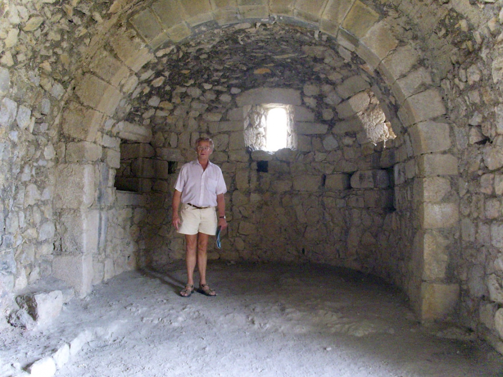
In the inner keep were all the domestic things; the chatelain’s house (the guardian of the castle), the open space where the soldiers ate, the cellar where the wines were kept, and the guardhouse by the big main entrance. There was a zig-zag path up to it on the south-facing side because the mountain was so steep. To reach it from the road also meant traversing a deep gorge.
I wondered at the time how, in those days over a thousand years ago, they were able to toil up to the castle, carrying huge building blocks, even if they were coming from the north-facing side where there was a stone quarry. The lords and the soldiers could have ridden sure-footed ponies; but the masons and workers?
On the south-west side of the castle, overlooking today’s village of Tuchan, is the Chapel of St. Anne. It is perched right on the edge of the cliff, with two inacccessible sides - one of the most urgent jobs of modern restoration was to build a walled pathway, a parapet, so that people could approach the chapel and see inside it in safety.
It measures only 18 foot long and 13 foot wide, but has a vaulted ceiling 13 foot high. But it has only three arrow-slits for light and a 1272 text mentioned arms and ammunition, as well as religious ornaments, as ordered for the chapel by Pierre of Mirepoix in 1262. It was obviously part of the defenses as well as a chapel.

St Anne was the mother of the Virgin Mary, and not a saint that one would imagine being worshiped by soldiers . . however, it’s thought the chapel was dedicated to St Anne much later, for her name did not appear on the Calendar of Saints until 1382. I strongly suspect the chapel was re-consecrated after that year because it has been previously Arian and then Cathar - heretic faiths. The chapel remained in use until the 18th century.
What role did Aquilar play in the resistance to the King of France during the Crusade against the Cathars? Some say it was never a Cathar castle, for it was never occupied by the Cathar sympathisers during the crusade against the “heretics” that was waged by the Catholic Church and the King of France. It was never attacked or besieged or taken in battle. But the story is more subtle than that.
The castle became part of the holdings of one Olivier de Termes, who was born in 1200 at Termes, a village in the Corbières between Lagrasse and Mouthoumet. His family ruled over some sixty villages and hamlets and they were Cathars. The castle of Termes was taken by Simon de Montfort in 1210, after a three months siege, and Oliver, only ten years old, lost his father and all his inheritance. He fled to his mother’s home in Catalonia and there met Raymond the Count of Toulouse and Raymond Trencaval, the Viscount of Carcassonne, Cathars both. He was educated by his uncle, Benoît de Termes, who became a Cathar parfait in the Razes area.
Somehow Aquilar had remained in the family’s hands; Olivier went to live there in 1228. By this time Simon de Montfort was long dead and the Inquisition was rounding up the remaining Cathar leaders one by one, and burning them at the stake. But Catharism was by no means dead. Trencavel, Olivier de Termes and the garrisons of Quéribus and Peyrepertuse, launched guerilla raids on the troops of the King. Until 1240 Aguilar remained the meeting point for the knights who had sworn allegiance to the Cathar Trencavels.
But King Louis IX - known as Saint Louis - had realised how valuable Aquilar might be in defending France from Spain. History doesn’t know the details, but in 1241 Olivier made his submission to King Louis, was apparently converted to Catholicism, gave the king his castle, and joined the Crusades in the Holy Land to fight for the king. It seems that he proved his worth and Aquilar was returned to him in 1250.
Meanwhile, in 1244 the famous castle of Montségur had been taken by the armies of the Catholic church, while King Louis was away in the Holy Land, and everyone thought that was the end of Catharism. But it was not.
The Cathar Perfects continued their teaching and ministry, evading the Catholic Inquisition by hook or by crook. The castle of Queribus, 16km to the west of Aquilar, became their new “safe house” and stronghold. In 1255, Louis and his faithful Olivier de Termes, came back from the Holy Land, and Louis decided that Catharism must be wiped out once and for all, and the castle of Queribus was to be taken.
Somehow Olivier persuaded the King that he could negotiate an honourable surrender. It took two years. Olivier put forward the argument that the true enemies of Catholicism were the Moors, and the Cathars could not be considered enemies of Christianity if they surrendered and the heresy was ended. Olivier masterminded it that they could leave for Spain or Italy, where Cathars were not being prosecuted. They surrendered, in 1257.
He then returned to the Holy Land. The king for whom he had given his life and castle died at Tunis, trapped with his fleet of boats in the harbour there in 1270, and Olivier himself died in battle at Acre in 1274.
This is one of the strangest stories to come out of the history of the Cathars. Whose side was Olivier on? French guide books tell us he opposed the “Albigensian Crusade”, that is, the persecution of the Cathars, and protected them, but also became a “steadfast supporter” of King Louis. What Oliver’s personal beliefs were no one knows, but the guide book to Aquilar hints; He undoubtedly inherited from the Cathars in his family the rejection of luxury and the taste for simple and down-to-earth things.
If some Cathars went to Aquilar, there is no surviving record of it, even though the “heresy” lasted another 60 years. It did not die easily and there was a safe house at Arques, near Rennes-les-Bains. I think Aquilar was another, for much arms and ammunition were placed in the Chapel of St Anne at Aquilar in 1262.
In 1258, after the French kings were victorious over the Cathars, the castle had been fortified against the powerful Aragons in the Pyrenees. Perhaps that’s why the arms were introduced, though why they would be kept in the chapel of St Anne is not explained. But it was 1382 before the chapel was dedicated to St. Anne . . . . I think Aquilar was more Cathar than anyone has ever dreamed.
The chapel of St. Anne is on a rocky promotory with 2 inaccessible vertical sides . . . it was partly fortified, therefore. It is 25 metres to the west of the entrance to the castle. A declaration of the chatelain Pierre de Mirepoix, dated 1262, described the ornaments necessary for the chapel. Funny, that’s the same year the weapons were hidden there. This all hint at disguise and deception here.
Aquilar slowly declined. By 1343 there was only a chatelain, a porter and a gatekeeper, plus 12 sargents; no great lord, no king, no jousts in the lists. Yet Sainte Anne’s chapel was consecrated in 1382 or later. I know that if a church or chapel had been used the the Cathars, it had to be reconsecrated.
Aquilar had been fortified to defend the border between France and Spain, but never used, until the Treaty of 1659 it was the village of Tuchan on flat ground that was attacked, rather than the castle. The Treaty of the Pyrenees displaced this frontier further south and Louis XIV married the Infanta of Spain, Marie Thérèse.
The King of France no longer needed Aguilar.
In the 19th century, after the Revolution, marauders and charcoal-burners moved in, then shepherds with their herds of sheep. The stones beautifully cut by the masons of the king of France were used to build many shepherd’s huts. Still, what does survive is magnificent. At the dawn of the 20th century, with the rise of interest in science among ordinary people, associations were formed according to the Law of Association, and the Friends of Aguilar came into being. They are now renovating and publicising the castle, working in their spare time.
And when one climbs up and admires the magnificent views, one can understand their fascination with this beautiful and historic part of the world; a world away from the world. Click here for a film
This village features quite strongly in my book, "The Sacred Journey." Click here for details.

Inscrivez-vous au blog
Soyez prévenu par email des prochaines mises à jour
Rejoignez les 96 autres membres